10 observations about my new world map shower curtain
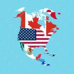
1. The map includes states and provinces, but only for the U.S. and Canada — which is to say only for the two countries in the world whose states and provinces I could already identify on a map. This diminishes the educational potential of my shower curtain. You'd think they'd at least have finished off North America and done Mexico too, but no. So I still don't know Durango from Jalisco.

2. The curtain was made in China. The map shows 43 Chinese cities. Granted, China has at least 47 cities with a population of 1 million or more, but I can't help but wonder if one of these little black dots on the map was slyly added by someone in the factory where this curtain was made.
3. Does a plastic shower curtain count as a Chinese "textile"?
4. The map uses only six colors (the oceans are clear) without using the same color for adjacent countries, states or provinces. They screwed up twice: Italy and Austria are both orange; Idaho and B.C. are both blue. This is doubly disappointing because these areas should've been easy. I'd have let it slide in New England or the Balkans — or even there in the Alps if they'd tried to fit Liechtenstein in, which they didn't — but in the Northwest it's just inexcusable. This is starting to bug me.
5. I wouldn't recommend a Peters Map if you're sailing around the world, but if you're making a shower curtain and you need to squeeze in the names of all 50+ countries in Africa it's probably a better choice than the navigation-friendly Mercator. The traditional Mercator, however, does give you tons of room to write GREENLAND and ELLESMERE ISLAND in as large a font as you'd like.
6. Since, as I said, the map does not include states and provinces except for in North America, it does not indicate the location of Waziristan. But I know where it is. And I know who it's become home to. And sometimes I look at that part of the map and I wish that God or karma or something would step up and do the job that our incompetent and easily distracted-by-shiny-things commander-in-chief has shirked for more than four years now.
7. Viewed backwards, from in the shower, I think my favorite word is "Galapagos."
8. There is something about islands on a map that makes me want to go there, to be there. It's almost the feeling that C.S. Lewis liked to describe as sehnsucht. I have no idea why looking at islands on a map should have such an effect, but for me it does. I would like to see Malta and Mauritius. I would like to stand on Kerguelen, Socotra, Tuvalu and Torshavn, to visit the Canaries, the Lines, the Gilberts, even the Belchers (in the summer).
9. I was only 13 and not really paying much attention at the time, and I'm sure there were Important Principles at stake and all, but I still can't help thinking, when I look at the Falklands on a map, that if people really want to have themselves a war they really don't need much of an excuse.
10. I think the same thing whenever I look at Iraq on that map. It's really quite a long ways away from Waziristan.