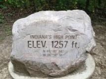
This past weekend, my family was exploring around in East Cenral Indiana. I happened to know that the highest point in the state was in the area where we were, near Richmond. The fact that the highest point in the state is found anywhere near here might come as quite a surprise to anyone driving around the area because it isn’t exactly what one would classify as hilly. In fact, for the most part, it is flat. But we decided that, since we were so close, we’d seek out the spot and cross it off our “bucket lists.” So we drove out into the Amish farm country and finally found it. From the road it looks like this…
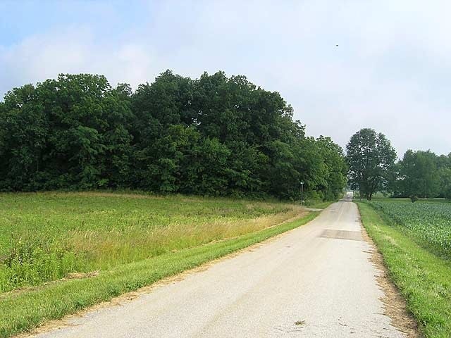
That’s right, that little tiny rise of woods, just to the left of the road there, hides the highest point in elevation in the whole of the Hoosier state. Impressive, no?
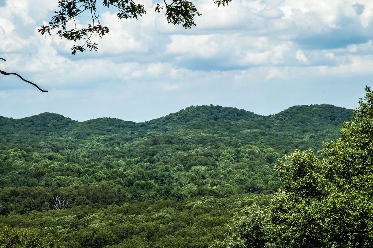
Now, for those of you who may be reading this in other parts of the world, I don’t want you to get the impression that this is the most impressive hill in Indiana. While we may not be able to boast great mountains, the southern third of our state does have some pretty good sized hills. There are plenty of places that will wear you out to hike through in southern Indiana, as these pictures will illustrate…

But those Southern Indiana hills don’t get to claim highest point status because their starting points are at much lower elevation than those in the flatter east central portion of the state. Look again at the picture of the high point.

The little parking area there at the corner of the woods is probably at an elevation of about 1250 feet above sea level. From there, you walk about 20 yards into the woods, gain about 7 feet in elevation, and, voila, you have arrived at Indiana’s pinnacle! By contrast, the bases of the hills in southern Indiana start at elevations of anywhere from 600 to 700 feet above sea level and climb up to 900-1000 feet or so. A much more impressive climb, but the final numbers just don’t stack up as high.
There just might be a life lesson in here someplace. Let’s look at another example.
The Appalachian Mountains achieve much lower elevation numbers than the Rockies. The highest peaks of the Rockies top out over 14,000 feet above sea level while no peaks in the Applachian chain can claim even half of that number. Looking at that data alone, one would get the impression that the mountains of the Rockies are more than twice as tall as those of the Applachians. Is this true? It depends on how you look at it.
Take this mountain, for instance…
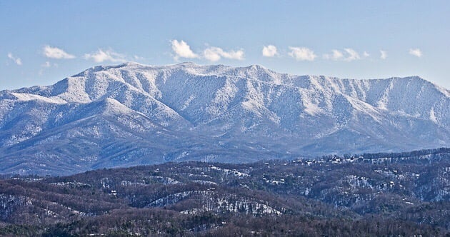
This is Mount LeConte, which sits at the edge of Gatlinburg, Tennessee. Its above sea level altitude tops out at 6,593 feet, making it one of the highest elevations east of the Mississippi, but that number pales in comparison to the elevations found throughout the Rockies. But there is more to it than those numbers. Mount LeConte starts out at a little over 1,000 feet in elevation, at its base. It gains over a mile in elevation from base to summit. That is the greatest such gain in the eastern U.S. and certainly nothing to sneeze at.
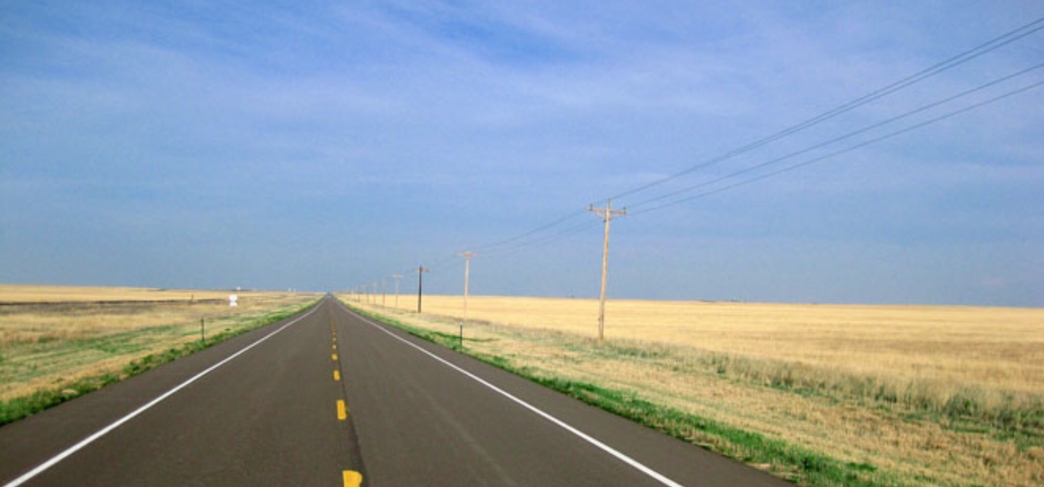
So what about the Rockies? Anyone with a grade school knowledge of U.S. geography can tell you that the city of Denver, Colorado is the “Mile High City”, meaning that the city, itself, sits at 5,280 feet above sea level. If you’ve ever driven out to Denver from the east, you know that it is not in the mountains…you can see the mountains from there, just to the west, but much of Denver, and especially the land to the east of it, is pretty flat. In fact, much of Eastern Colorado is flat as a pancake, more flat, even, than East Central Indiana. Here is a picture of Eastern Colorado…
The elevation above sea level of the land pictured above is very similar to the the elevations of the highest mountain peaks in the eastern U.S.
If you could pick up Mount LeConte from Tennessee and plop it down in Eastern Colorado, you’d have a mountain approaching 13,000 feet in elevation.
My little road trip to Indiana’s highest point got me to thinking about data, statistics, numbers, and claims in general. Numbers are useful, but they don’t tell a whole story. Statistics can be used to prove just about anyone’s agenda. I have friends on both ends of the political spectrum who often post politically charged statistical data about this hot button topic or that on their social media pages. The numbers they use add up, but they tell completely different tales. The real story can be found in the data they do not reveal. I hope that the majority of people can read between the lines and understand that anyone pushing an agenda is going to present biased info. I fear, however, that the majority of people are actually looking for data that justifies their agenda and confirms their biases.
Now for a final thought to take this a step further. Sometimes, in life, we may claim that we have reached great heights, or maybe we become depressed at the notion that we haven’t reached high enough. Remember, some people are like a Mount LeConte in the East, and some people are more like an anthill on the plains of Eastern Colorado, the numbers may add up, but the stories are very different. Perhaps, the real story of our success, or lack thereof, lies not in the high mark we reach but, rather, in how far we came from where we began.
So, whenever you are presented with some statistics someone wants you to believe, or the next time you are feeling a little too high, or a little too low, about your own accomplishments, pause for a moment and consider the lessons provided by flat lands, little hills, and big mountains.