I have written about the wise men elsewhere, with regard to how they could be guided by a star (astronomy — conjunctions — and constellations and meaning attached to the latter; phenomenological language as to the star’s “movements”), where they came from (likely northwest Persia) and “who” they were (likely priests of Zoroastrianism; neither “magicians” nor sorcerers):
Star of Bethlehem, Astronomy, Wise Men, & Josephus (Amazing Astronomically Verified Data in Relation to the Journey of the Wise Men & Jesus’ Birth & Infancy) [12-14-20]
Who Were the “Wise Men,” or Magi? [National Catholic Register, 12-16-20]
Skeptics of the story (mostly atheists these days: folks who delight in mocking Christianity at every turn and making it and Christians look ridiculous) seem to think it is unthinkable that such a journey could be made with the simple aid of a star in the west. Well, it’s not rocket science (then or now) to know and understand that Jerusalem was west of Persia: so that a star to the west having to do with a king (Jupiter and Regulus were associated with a king) and a lion (of Judah) — the constellation Leo, given an existing familiarity with Judaism, would logically lead to Jerusalem, both geographically and in the context of existing religions.
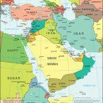
I just looked at my globe of the world and I saw that Jerusalem is almost exactly due west from northwest Persia: where the Magi likely came from, because they were from the Medes, who inhabited northwest Persia (present-day Iran). In current maps, Baghdad and Amman, Jordan are roughly on the line due west from this area. Baghdad was only built in the 8th century. Ancient Babylon lies about 53 miles south of Baghdad, but it was conquered by the Persians in 539 BC and was never the same again: eventually becoming a ruin and wasteland. The Wikipedia article on Babylon states that “A tablet dated 275 BC states that the inhabitants of Babylon were transported to Seleucia, where a palace and a temple (Esagila) were built. With this deportation, Babylon became insignificant as a city.”
So the Magi were certainly not directed (by signs they believe they read in the stars) there at the time of the birth of Christ almost three centuries later. Amman (ancient Ammon, in the region of the Ammonites in current-day Jordan) was not religiously significant enough at this time, either, and after the 4th century BC it was conquered by the Greeks, Egyptians, and Romans. So it was no extraordinary astronomical deduction to conclude that some important happenings due west were to occur in Jerusalem.
The question then becomes: how did they journey from Persia to Jerusalem? Was it just a fly-by-night random affair or were there known routes? The latter was in fact the case. An ancient “superhighway” of sorts, called the Royal Road, was “reorganized and rebuilt by the Persian king Darius the Great (Darius I) of the first (Achaemenid) Persian Empire in the 5th century BCE.” The Wikipedia article continues:
Darius built the road to facilitate rapid communication throughout his very large empire from Susa to Sardis . . .
The course of the road has been reconstructed from the writings of Herodotus,[4] archeological research, and other historical records. It began in Sardis near the Aegean coast of Lydia, traveled east through Anatolia (crossing the Halys according to Herodotus), and passed through the Cilician Gates to the old Assyrian capital Nineveh in upper Mesopotamia, then turned south to Babylon. From near Babylon, it is believed to have split into two routes, one traveling northeast then east through Ecbatana and on along the Silk Road (via the Great Khurasan Road), the other continuing east through the future Persian capital Susa and then southeast to Persepolis in the Zagros Mountains. Of course, such long routes for travellers and tradesmen would often take months on end, and during the reign of Darius the Great numerous royal outposts (Caravanserai) were built. . . .
More eastern segments of the road, identifiable in present-day northern Iran, . . . stretches of the Royal Road across the central plateau of Iran are coincident with the major trade route known as the Silk Road. This route was used by couriers to deliver messages to the Persian capital.
However, Darius I improved the existing road network into the Royal Road as it is recognized today. A later improvement by the Romans of a road bed with a hard-packed gravelled surface of 6.25 m width [20.5 feet] held within a stone curbing was found in a stretch near Gordium . . .
The construction of the road as improved by Darius was of such quality that the road continued to be used until Roman times.
The Royal Road was well north of Israel; even north of Damascus, Syria. So it couldn’t have been the entire route of the Magi. Most of the rest would have very likely been the equally famous ancient road: the King’s Highway, which, according to Wikipedia, was:
. . . a trade route of vital importance in the ancient Near East, connecting Africa with Mesopotamia. It ran from Egypt across the Sinai Peninsula to Aqaba, then turned northward across Transjordan, to Damascus and the Euphrates River. . . .
[T]he Highway turned northward through the Arabah, past Petra and Ma’an to Udhruh, Sela, and Shaubak. It passed through Kerak and the land of Moab to Madaba, Rabbah Ammon/Philadelphia (modern Amman), Gerasa, Bosra, Damascus, and Tadmor, ending at Resafa on the upper Euphrates. . . .
The Nabataeans used the road as a trade route for luxury goods such as frankincense and spices from southern Arabia. It was possibly the cause of their war with Hasmonean Alexander Jannaeus and with Iturea in the beginning of the 1st century BC.[2]
During the Roman period the road was called Via Regia. Emperor Trajan rebuilt and renamed it Via Traiana Nova, under which name it served as a military and trade road along the fortified Limes Arabicus.
Note that the King’s Highway reached all the way to the Euphrates River, and came to an end at Resafa [the biblical Rezeph: see Is 37:12]. The Royal Road also crossed the Euphrates: not far from Resafa, near Melitene (modern Malatya) in Syria. The distance between Resafa and Melitene was about 265 miles. Catholic Encyclopedia (“Magi”), on the other hand, expressed its opinion on the connecting route as follows:
They probably . . . reached either Haleb (Aleppo) or Tudmor (Palmyra), and journeyed on to Damascus and southward, by what is now the great Mecca route (darb elhaj, “the pilgrim’s way”) [basically the same as the King’s Highway], keeping the Sea of Galilee and the Jordan to their west till they crossed the ford near Jericho.
Aleppo and Palmyra were located on the western route of the Silk Road: a sort of successor to the Royal Road, at least in part. It was greatly flourishing as a means of east-west trade at the time the Magi would have traveled on it. The distance from Aleppo to Damascus is about 192 miles, as the crow flies, while Palmyra is 134 miles away.
A UNESCO site elaborates on the relation between these two great roads:
Although the idea for such a highway may have been borne out of military and political considerations, the Royal Road went on to serve as an integral link in the Silk Roads. This was enhanced largely by Darius’ own modernisation of the road through the introduction of systematic military checkpoints alongside Caravanserai. Travellers were therefore not only offered a place to sleep for the night and the chance to change horses, but were also guaranteed safety. These protected caravanserais ensured that in the years following the fall of the Persian Empire the road continued to be used by merchants and traders crossing the route.
The Magi would have to simply follow one or the other great roads (Royal Road / Silk Road) to one of these cities, and then travel to Damascus and ultimately Jerusalem via the King’s Highway. These were the “big highways” of the ancient world in the near eastern region. Between the three, and possibly some relatively short connecting routes (just as it was with, for example, the Oregon Trail and various “shortcuts” in the American West), the entire journey can be visualized and mapped with a fair degree of likelihood or probability: just as most travelers by car in America are likely to take interstate freeways on long trips.
In any event, they weren’t following a star literally every moment. The Bible doesn’t say that. It only states that “the star which they had seen in the East went before them” (Mt 2:9, RSV), referring solely to the six-mile journey between Jerusalem and Bethlehem: and all that meant was that a very bright Jupiter (by the astronomical calculations I have proposed, in December, 2 BC) was then due south from Jerusalem, so that it looked like it went before them, as they traveled .
They had already ascertained that a prominent star to the west (a conjunction, or series of them, as we now can reasonably surmise, based on astronomical charts) suggested a king being born in or near Jerusalem. The language of “went before” and “came to rest over the place where the child was” is easily explainable as phenomenological language, which is very common in the Bible. But the charts say it was 68 degrees up in the sky, so that it would have looked like it was shining on Bethlehem (which was already named by the prophecy in Micah 5:2, as Matthew 2 again presents in the narrative).
My point is that the “celestial navigation” played a relatively minor role in the journey of the wise men. Most of it was laid-out according to well-known travel and trade routes already long-established. To travel to Jerusalem from Persia, they had to go around the Arabian Desert and Syrian Desert via the Fertile Crescent, just as Abraham had done from almost-as-far Ur of the Chaldees, near the mouth of the Euphrates, about ten miles from Nasiriyah in modern Iraq. The distance from Susa in ancient Persia, to Ur was about 186 miles.
Thus, they basically followed the path of Abraham’s journey from Ur, with an added 186 miles: which the great patriarch had traveled some 1800-2000 years earlier. They didn’t need a star to guide them all that way, anymore than Abraham did. They simply followed the water and the fertile land outside of the desert, with the understanding that they were making their way to Jerusalem.
The more difficult and interesting question about their journey is: what route did they take back? The Bible states that “being warned in a dream not to return to Herod, they departed to their own country by another way” (Mt 2:12). They may have followed the coastal route on the Mediterranean Sea, till they were out of reach of Herod (probably most likely), or else they actually went across the Arabian Desert (here’s a map showing both routes in 1300 BC). There are various ways to find water, even in the desert. And since their land was likely due east, the rising sun is all they required for broad navigation: especially taking a more direct route across the desert. The camels did the rest.
***
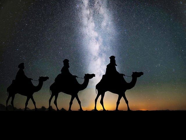
Photo credit: 27707 (1-20-16) [Pixabay / Pixabay License]
***